|


...shall take place via Survey123 and will be open to all conference exhibitors and attendees. Voting Survey Opens: 9:00 AM on Tuesday, September 26 Voting Survey Closes: 3:00 PM on Tuesday, September 26 
|

Note: There is no limit to the number of any type of poster entries we can take!
Must register for the OKSCAUG Conference to submit a poster entry.


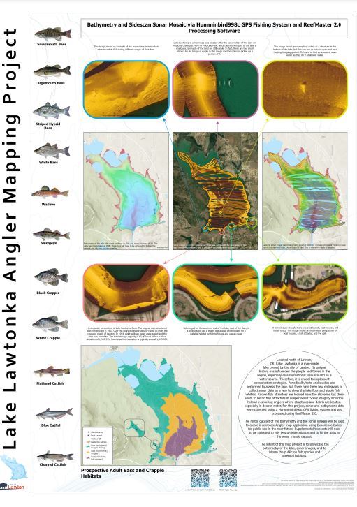
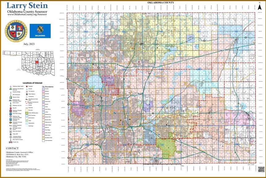
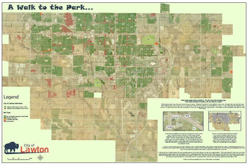
Located north of Lawton, OK, Lake Lawtonka is a man-made lake owned by the city of Lawton. Its unique history has influenced the people and towns in the region, especially as a recreational resource and as a water source. Periodically, tests and studies are performed to assess the lake, but there have been few endeavors to collect sonar data as a way to show the lake floor and viable fish habitats. Although SCUBA diving can be a useful survey method of fish habitats, the visibility level in Lake Lawtonka is poor, and this method would be time intensive for mapping purposes. Sonar and bathymetric data were collected using a Humminbird998c fish finder and was generated using ReefMaster 2.0. | Oklahoma County Galen Hanby, Karl Strayer, Chris Bodzioch This is a 24x36 map of Oklahoma County including commissioner districts, city boundaries, township and range, and other locations of interest, and was created to update the previous county map from 1997 which showed the statewide map numbering system for quarter sections. Technology such as ArcGIS Pro provides a straightforward approach to demonstrate spatial information in a way that was not previously possible. This map is able to display various facets of Oklahoma county as well as providing a template to facilitate future revisions. We utilized unique symbology to represent local places, attractions, and features. We also found updating hydrology and roadways to be a large part of the mapping process. Many of the ponds and streams had to be drawn from aerial imagery. Likewise, the courses of some roadways had to be redrawn or created. Formatting colors, labels, and symbology were substantial parts of this project with numerous revisions until the final edit which you see here. | Cities are increasingly aware of the importance of parks and greenspaces to their citizens. “A Walk to the Park…” identifies which addresses in the City of Lawton, OK do have pedestrian access, by either a local street or a maintained sidewalk, to a park or greenspace and which addresses have no access to a park by foot. This map highlights areas where additional parks or green spaces are needed or where there is a need for better pedestrian accessibility options.
|

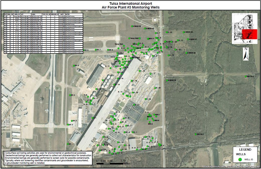
5-Year Property Value Trends Across Oklahoma County Zachary Knepp, Karl Strayer, Chris Bodzioch Got feedback? Email the presenter! Oklahoma County Assessor’s office is responsible for discovering, listing, appraising, and assessing real and personal property for tax purposes within Oklahoma County. The office gathers and preserves an archive of property data spanning many years. The purpose of this research is to show how residential property value changed over a five-year period (2018 - 2023). Like the rest of the country, Oklahoma County experienced a progressive residential market following covid. The increasing value of residential property sales shows evidence of an upward trajectory of Oklahoma County property value. Five years of data were pulled between a six-year period 2018 – 2023, excluding 2020 year. The years of data were condensed into a single map by calculating percent change for each property, percent change = ((2023 value – 2018 value) / 2018 value) * 100. Percent changes were categorized into bins, assigned a gradient color that visually represents upward or downward trends, and then mapped. | Air Force Plant 3 Monitoring Wells Janelle Williams Got feedback? Email the presenter! Subsurface soil boring activities are used for environmental or geotechnical purposes. Geotechnical borings are generally performed to collect soil characteristics for construction. Environmental borings are generally performed to screen soils for possible contaminants. Typically, where soil screening identifies contaminants and groundwater is encountered, a groundwater monitoring well is installed.
|

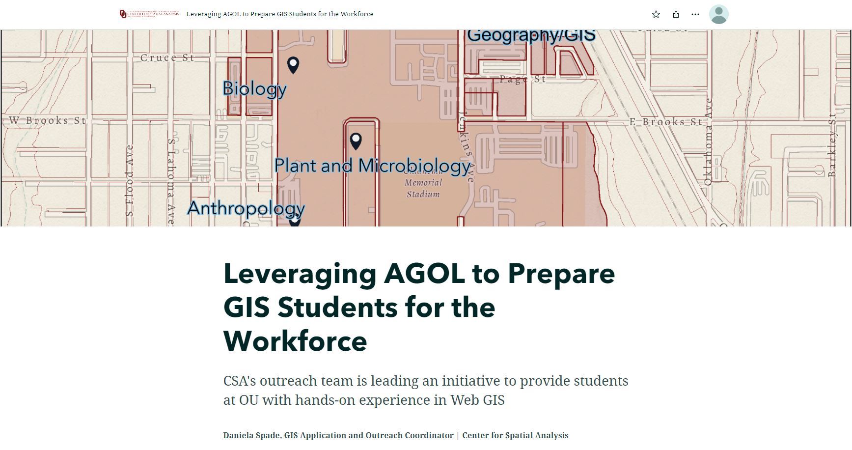
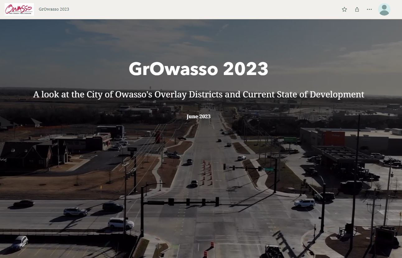
Fansteel Metals/FMRI Open House Presentation Makenna Hartman, Kelsey Bufford, Amy Brittain Got feedback? Email the presenters: This Story Map was played during the open house for a proposed Superfund site and was intended to convey historical and current relevant information about the site and its reason for proposal to the National Priorities List. We also wanted to provide more information about the Superfund process, the role DEQ plays in that process, and what that might look like for the community the site was located in. As such, this Story Map contains historical photos of the ore process used at the site, what the site currently does to prevent the spread of contamination from onsite ore waste materials, and maps of the site's location in addition to currently listed Superfund sites in Oklahoma. There is also a simplified diagram of the Superfund process to assist in understanding the very complex path Superfund sites can take on the road to remediation. | Leverage AGOL to Prepare GIS Students for the Workforce Daniela Spade Got feedback? Email the presenter! StoryMap presentation on the ways in which CSA's outreach team works with students and professionals to ensure students are prepared for the workforce in GIS. | GrOwasso 2023 Wendy Kramer, Chelle Mount, & Alexa Beemer Got feedback? Email the presenter! This StoryMap was created for a presentation to share a brief history on the City of Owasso, as well as highlight the two zoning overlay districts that the Owasso Zoning Code currently has in place. It also shows current trends in development that the City of Owasso is seeing in 2023 and factors that our planning team thinks will continue to spur new development. |

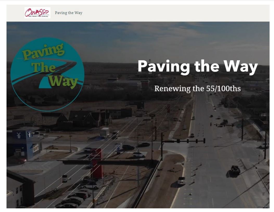
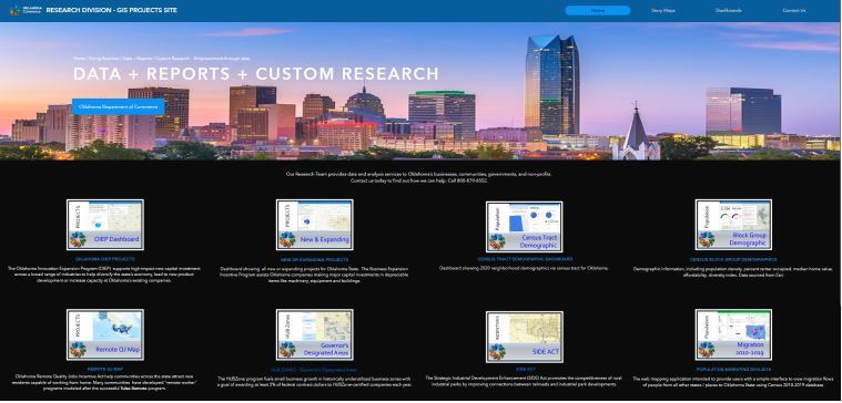
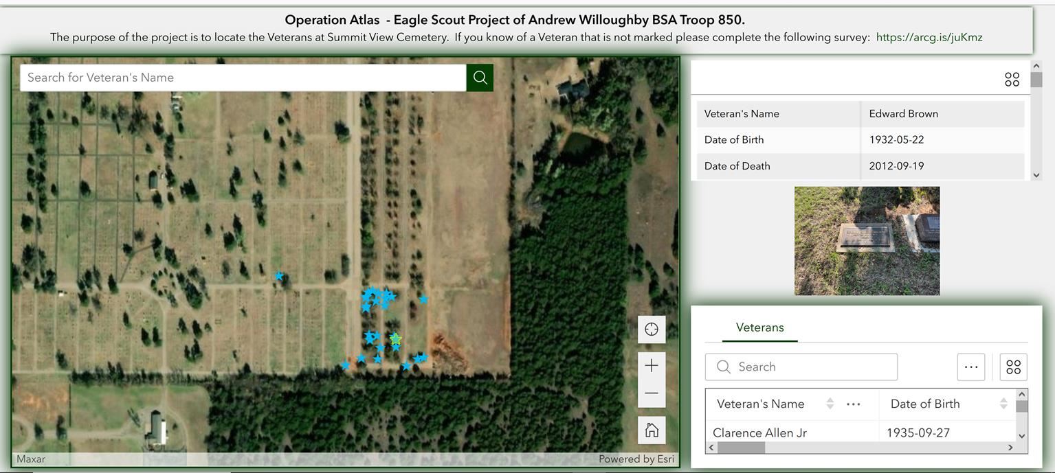
Renewing the 55/100ths Michelle Mount, Shellie Wingert, Roger Stevens, Alexa Beemer, Elishya Cook, Jerry Fowler, Jeff Atchison Got feedback? Email the presenter! Sales Tax is an essential part of maintaining funding for Oklahoma cities. The City of Owasso educated voters about a sales tax renewal for Transportation Projects this year. City Officials formed a team to create educational materials to share our story. The story walked citizens through how sales tax is used for streets, sidewalks, and trails. The Storymap included the history, upcoming projects, costs, and benefits to the community. Using comparison sliders, we looked at before and after imagery of past street projects. Team members created custom graphics to tell the story. One illustration explained the effects of the sales tax on citizens' finances; For every $100 spent, 55 cents goes to fund transportation projects. The final product resulted from a great team working to educate our community. | RESEARCH DIVISION - GIS PROJECTS SITE Dat Nguyen Got feedback? Email the presenter! An Experience Builder is used as a HUB to hold various current Commerce Projects. | Operation Atlas - Mapping the Veterans of Summit View Cemetery in Guthrie, OK Andrew Willoughby BSA Troop 850 Each Memorial Day the Boy Scouts of Troop 850 place flags on the graves of Veterans to recognize them for their Service. For his Eagle Scout Project Andrew wanted to find a way to map the Veterans at the Cemetery to make sure that Veterans weren't missed during their day of recognition. Using Survey 123 and Experience Builder a survey and web app were built. On October 1 volunteers will meet at Summit View Cemetery to locate, gather information, and photograph the headstones so that Veterans can be recognized at the Cemetery and online. Once the data has been captured a sign will be placed at the Cemetery that will allow visitors access to the web based experience.
|
Contact SCAUG at : Webmaster@scaug.org | South Central Arc Users Group P.O. Box 96 Ardmore, OK 73402 |
