


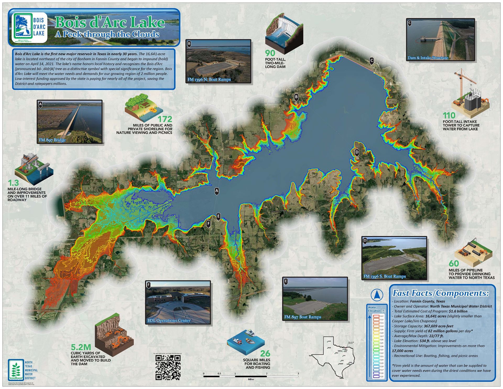
Colin Goralczyk - North Texas Municipal Water District Bois d'Arc Lake: A Peek Through the Clouds Located in Fannin County, near the city of Bonham, TX, Bois d’Arc Lake is the first new major reservoir in the state in nearly 30 years. Owned and operated by the North Texas Municipal Water District, this lake sets its sights on meeting the growing demand for water in a region of over 2 million north Texas residents. Equipped with a two-mile-long dam, multiple public boat ramps, a lake operations center, and more, this body of water will not only provide resources to the people of north Texas, but recreational aspects such as boating, fishing, and designated picnic areas. Bois d’Arc Lake began impounding water on April 14th, 2021, and continues to fill as it approaches its future conservation pool elevation of 534 ft. To learn more, please scan the QR code located on the map exhibit or visit boisdarclake.org.
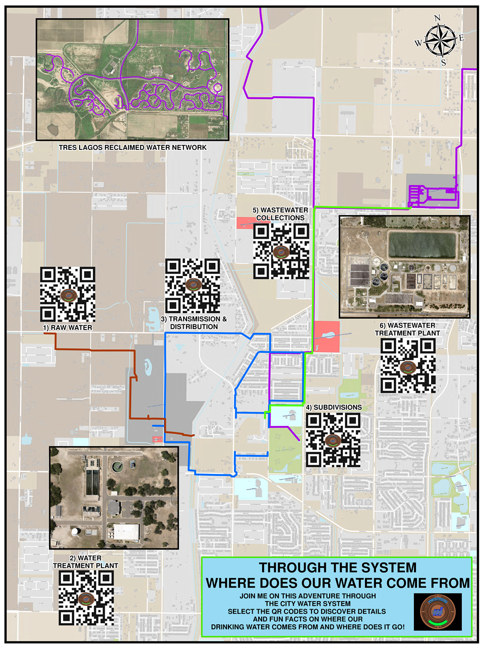
| Patrick Gray - McAllen Public Utility Through the System: Where Does Our Water Come From A detailed adventure to how raw water is collected and passed through a municipality for consumption. Each landmark will send the reader to a story on where raw water comes from, how water is treated from a Water and Wastewater plant and where treated water goes.
| Sherrie Hubble and Dawn Warrick - Freese & Nichols Story Map: The City of Siloam Springs 2040 Comprehensive Plan The City of Siloam Springs, Arkansas has adopted the Our Vision, Our Future: 2040 Comprehensive Plan to help guide the City’s growth and future development over a 10-to-20-year period. Seeking an innovative way to present their 18-month journey from early planning through adoption, the City and authors created an ArcGIS StoryMap to complement the full Plan document. With an emphasis on community engagement, the story outlines the Plan’s structure, vision, and guiding principles in a simple, yet highly visual and interactive way. The StoryMap also utilizes a series of interactive maps to illustrate the planning area, existing and future land use, as well as transportation and mobility.
|
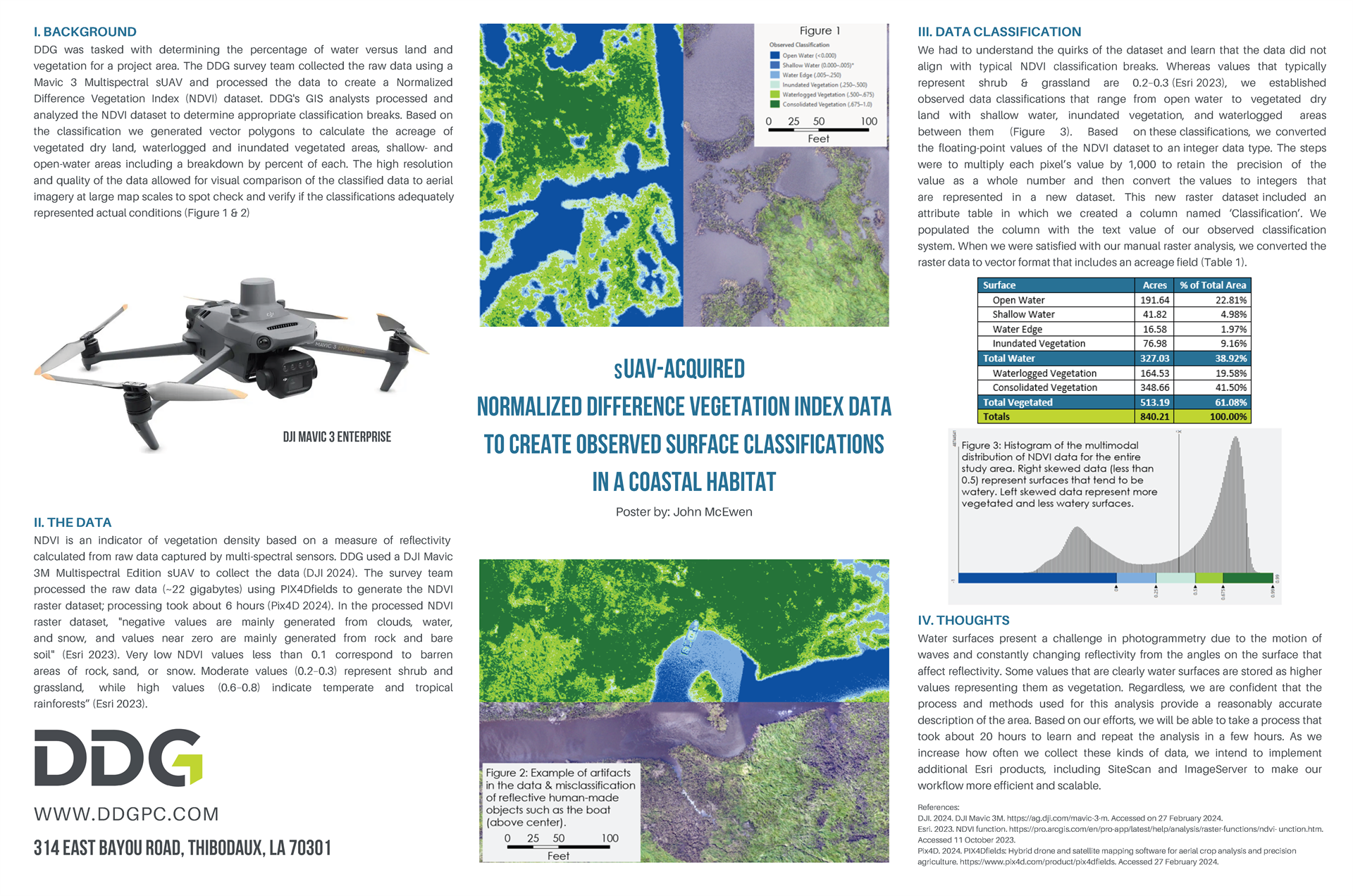
John W. McEwen - DDG sUAV-Acquired Normalized Difference Vegetation Index Data to Create Observed Surface Classifications in a Coastal Habitat For a project that required determining the amount of vegetation in a coastal area, DDG's survey team and small Unmanned Aerial Vehicle (sUAV) operators acquired visible spectrum and multispectral data. Multispectral data were processed into a Normalized Difference Vegetation Index (NDVI) dataset. Converting the data type of the high resolution of the data allowed GIS analysts to develop ground-truthed classification compared to the aerial imagery captured in the same sUAV flights. Large scale map comparisons are provided to demonstrate how these classifications based on the NDVI data classifications compare to aerial imagery.
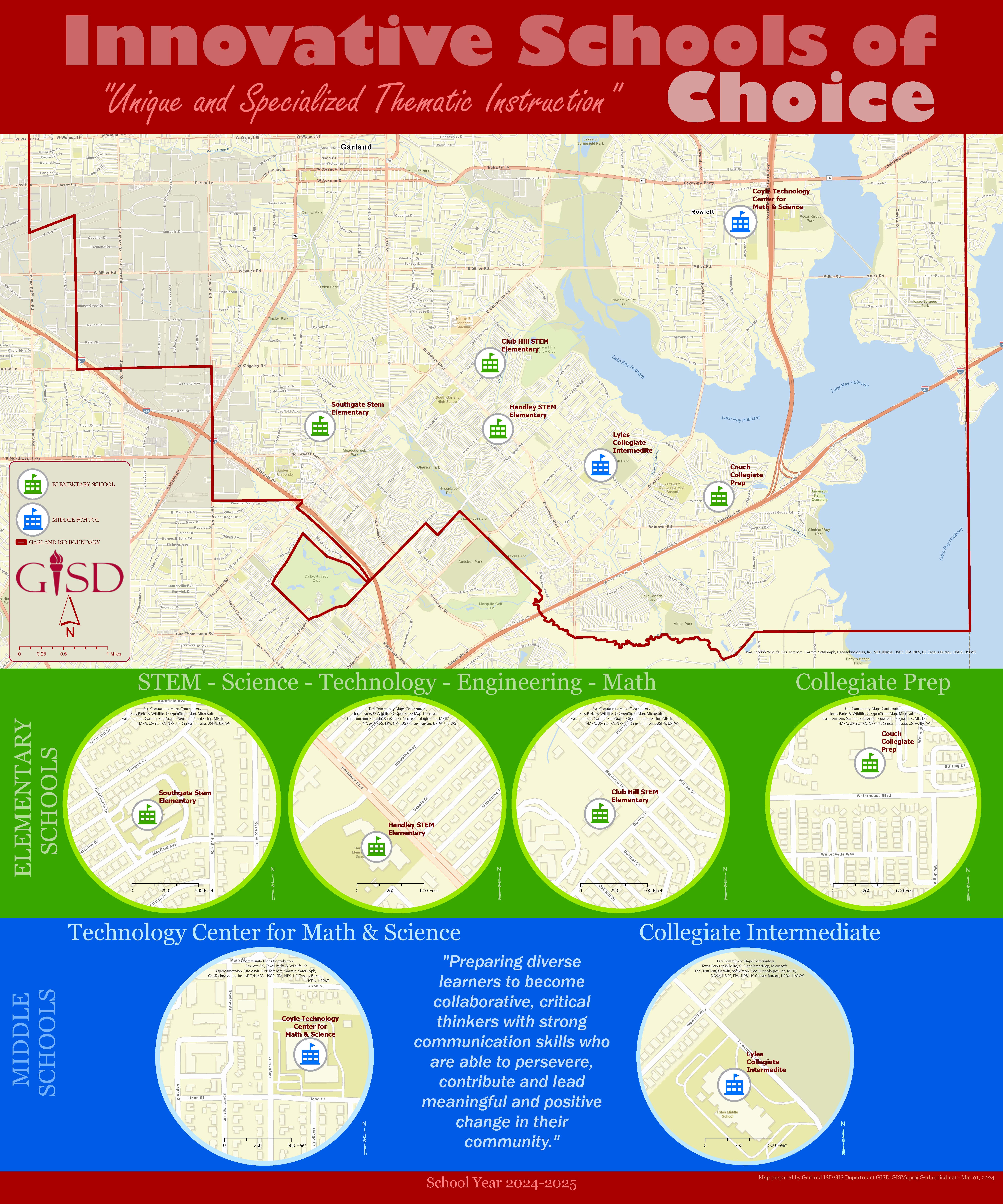
| Robert Oleson - GISD Innovative Choice Six of our Garland Independent School District (GISD) schools are in the process of transitioning to new Innovative Schools of Choice. Campus administrators, district leaders and the school communities collaborated in developing themes for the new schools that would be attractive to neighborhood students. Whether the focus is on STEM or Collegiate curriculum students will be offered innovative, hands-on learning experiences and given opportunities to participate in enrichment programs that will help shape their future and give them a strong foundation to enter the modern 21st century workplace.
| Kristi Shannon - City of Lawton, OK Lawton Annexations Mete Lawton and discover how the city boundary has changed over the decades since its founding in 1901. This poster is the result of a collaborative effort to digitize annexations and de-annexations. ArcPro was used to digitize, create the map, and calculate area.
|

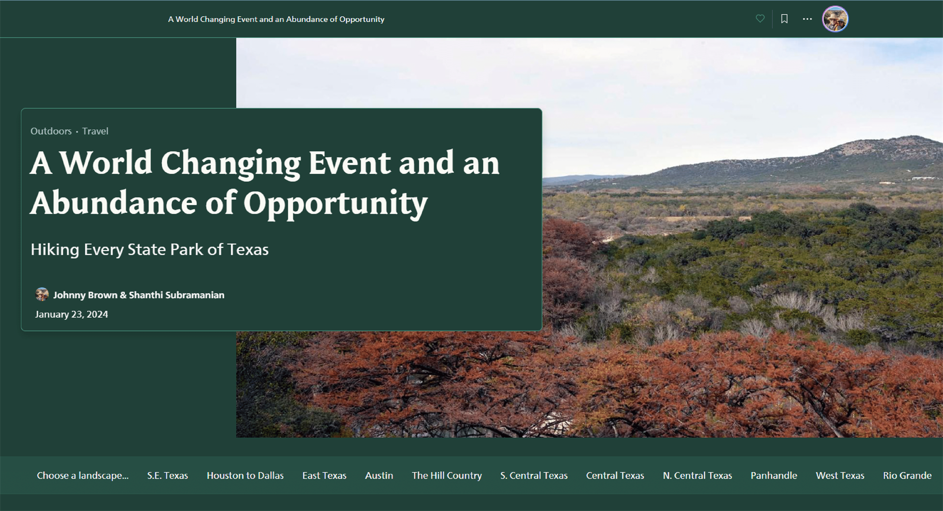
Johnny Brown - Harris County Story Map: A World Changing Event and an Abundance of Opportunity: Hiking Every State Park of Texas Texas is a large place with a vibrant history spread across practically every landscape imaginable. Want to explore the coast, learn about the past, hike a forest, climb a mountain? Pick your spot and go!
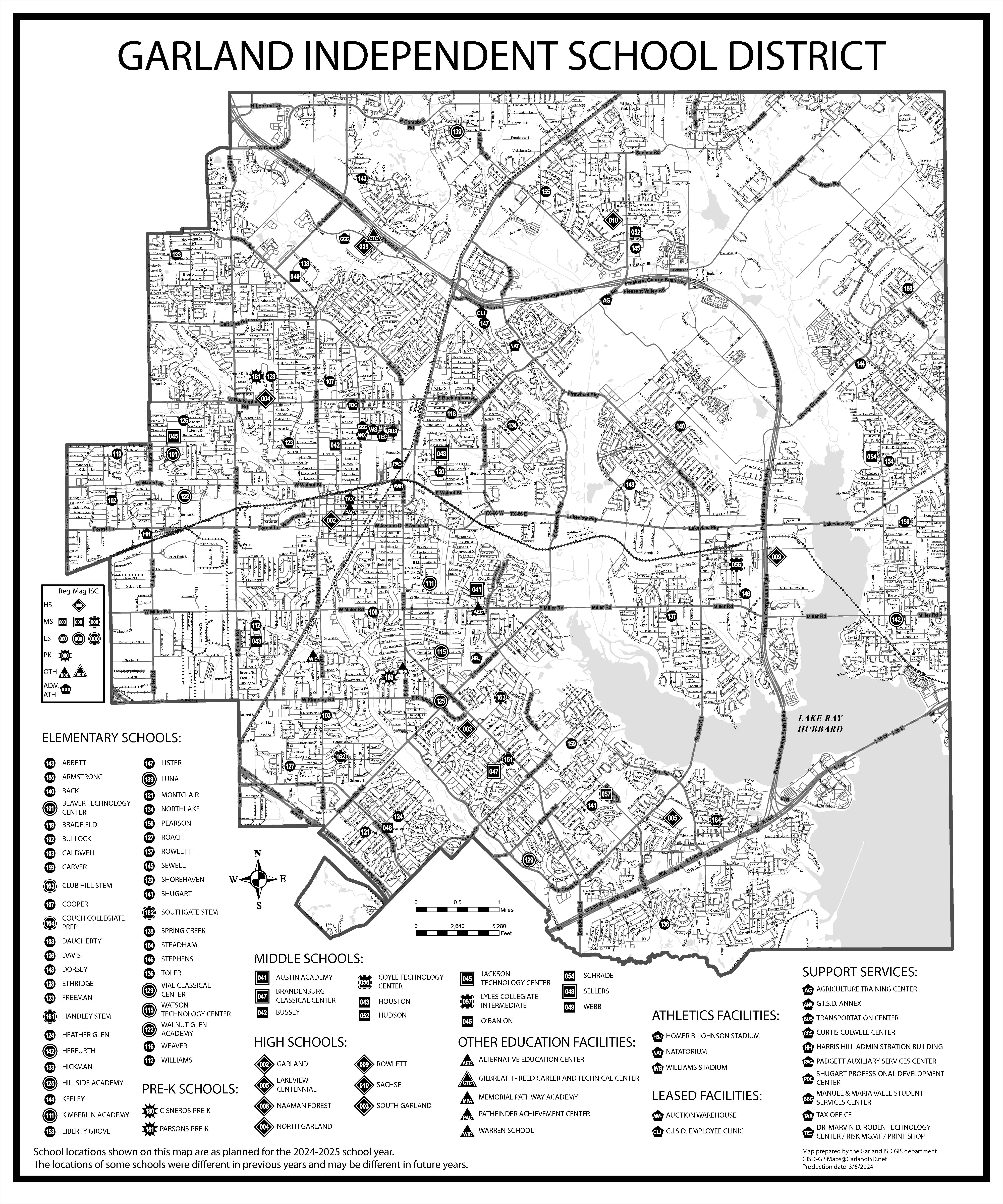
| James Walker - Garland ISD Garland ISD Streetmap A street map showing school locations in Garland ISD
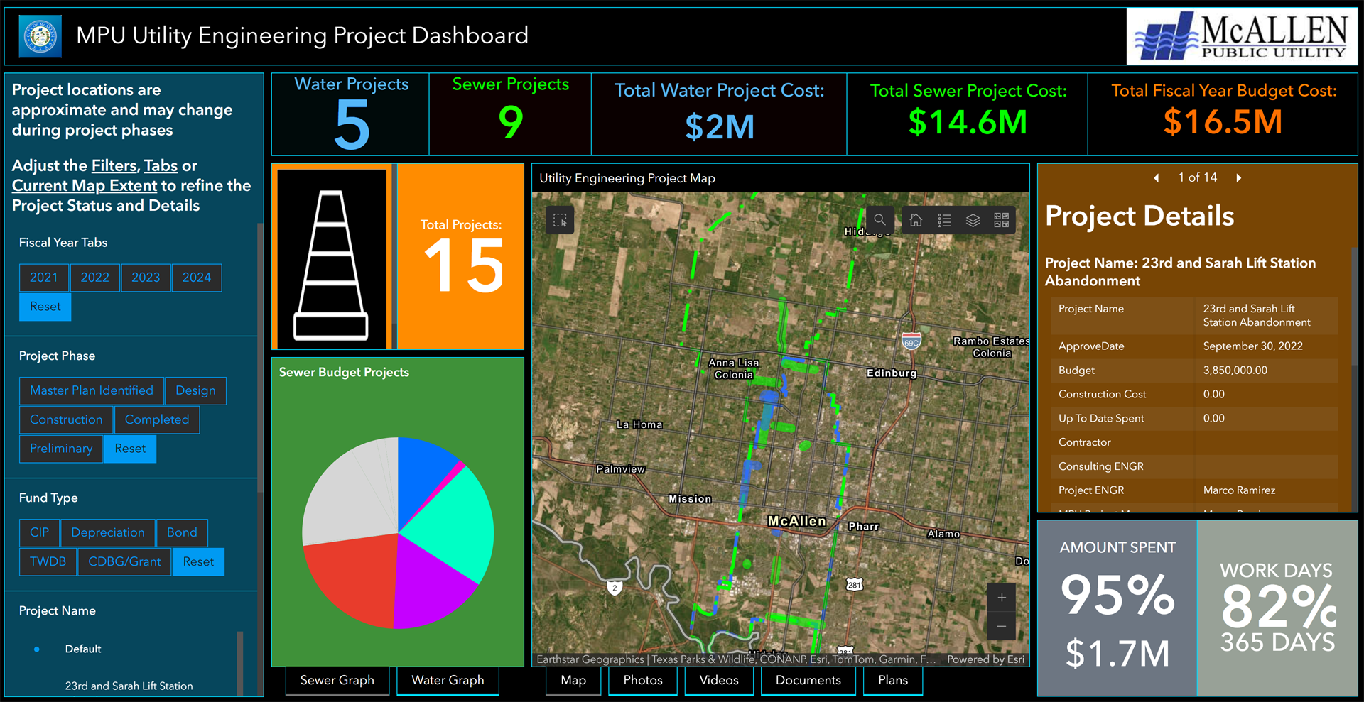
| Patrick Gray - McAllen Public Utility Utility Engineering Project Dashboard The City of McAllen Utility Engineering department is getting ready to launch a visual Dashboard App to inform the public of all Capital Improvement Projects that are in the planning phase or are currently under construction. As more information is collected, the public will be fully aware of where their tax dollars are being spent! https://www.arcgis.com/apps/dashboards/2f34ee775adf475d93f3edc69d7b315e
|

Contact SCAUG at : Webmaster@scaug.org | South Central Arc Users Group P.O. Box 96 Ardmore, OK 73402 |
