|


...shall take place via Survey123 and will be open to all conference exhibitors and attendees. Voting Survey Opens: 9:00 AM on Tuesday, September 20 Voting Survey Closes: 3:00 PM on Tuesday, September 20 
|

Note: There is no limit to the number of any type of poster entries we can take!
Must register for the OKSCAUG Conference to submit a poster entry.

 Posters")
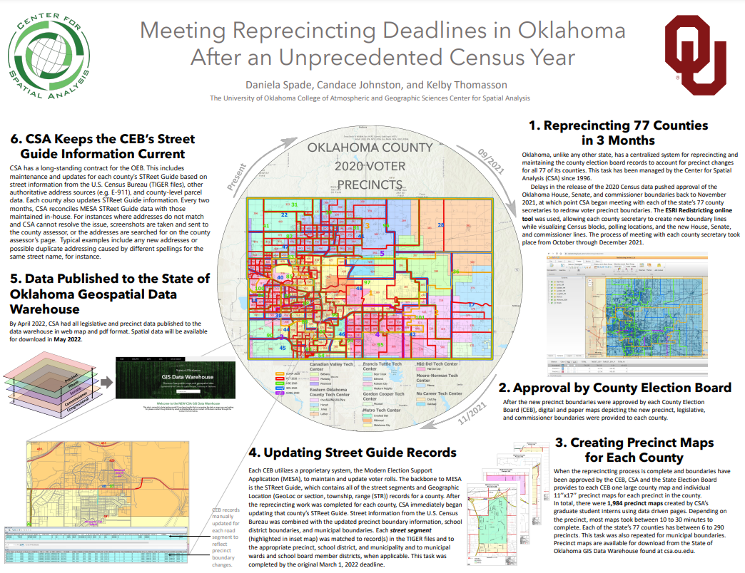
Meeting Reprecincting Deadlines in Oklahoma After an Unprecedented Census Year Daniela Spade, Candace Johnston, Kelby Thomasson University of Oklahoma Center for Spatial Analysis Oklahoma, unlike any other state, has a centralized system for reprecincting and maintaining the county election board records to account for precinct changes for all 77 of its counties. This task has been managed by the Center for Spatial Analysis (CSA) since 1996. Delays in the release of the 2020 Census data pushed approval of the Oklahoma House, Senate, and commissioner boundaries back to November 2021, at which point CSA began meeting with each of the state’s 77 county secretaries to redraw voter precinct boundaries. Here we summarize the workflow followed to ensure a timely delivery of maps and the associated geospatial data under a tight deadline.
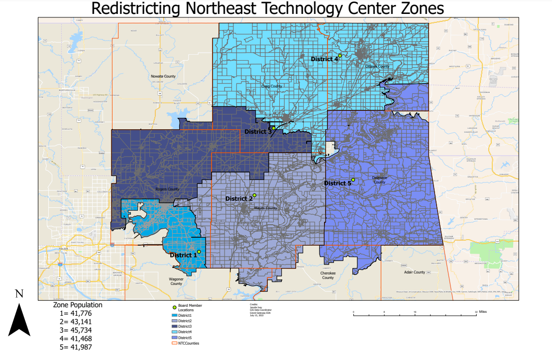
| Northeast Technology Centers Redistricting map Janelle Ivey GGEDA This is a map to show the new Board members district based off population. All the districts populations are within 10% of each other. I used the census block data for voting districts, as it is the smallest block data. The redistricting map has been approved and passed by the Northeast Technology Center Board.
| PICK Transportation Service Area map Janelle Ivey GGEDA Pelivan Transportation service now has a new after hours service called PICK Transportation. This serves the general public for rides as needed in the Northeast Oklahoma region and Cherokee Nation. Our Northeast Oklahoma rural communities lack in public transportation, and this new service has helped to alleviate that. This map represents the PICK Transportation service areas.
|

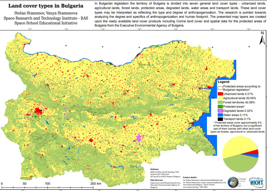
Land cover types in Bulgaria Stefan Stamenov & Vanya Stamenova Space Research and Technology Institute - Bulgarian Academy of Sciences In Bulgarian legislation the territory of Bulgaria is divided into seven general land cover types - urbanized lands, agricultural lands, forest lands, protected areas, degraded lands, water areas and transport lands. These land cover types may be interpreted as reflecting the type and degree of anthropogenization. The research is pointed towards analyzing the degree and specifics of anthropogenization and human footprint. The presented map layers are created upon the ready available land cover products including Corine land cover and spatial data for the protected areas of Bulgaria from the Executive Environmental Agency of Bulgaria.
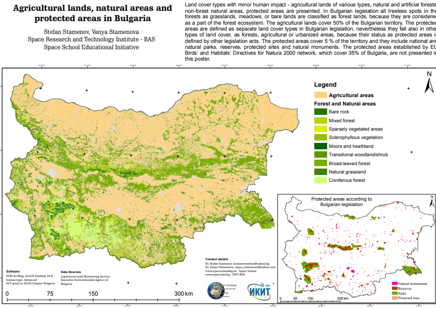
| Agricultural lands, natural areas and protected areas in Bulgaria Stefan Stamenov & Vanya Stamenova Space Research and Technology Institute - Bulgarian Academy of Sciences Land cover types with minor human impact - agricultural lands of various types, natural and artificial forests, non-forest natural areas, protected areas are presented. In Bulgarian legislation all treeless spots in the forests as grasslands, meadows, or bare lands are classified as forest lands, because they are considered as a part of the forest ecosystem. The agricultural lands cover 50% of the Bulgarian territory. The protected areas are defined as separate land cover types in Bulgarian legislation, nevertheless they fall also in other types of land cover, as forests, agricultural or urbanized areas, because their status as protected areas is defined by other legislation acts. The protected areas cover 5 % of the territory and they include national and natural parks, reserves, protected sites and natural monuments. The protected areas established by EU Birds‘ and Habitats‘ Directives for Natura 2000 network, which cover 35% of Bulgaria, are not presented in this poster.
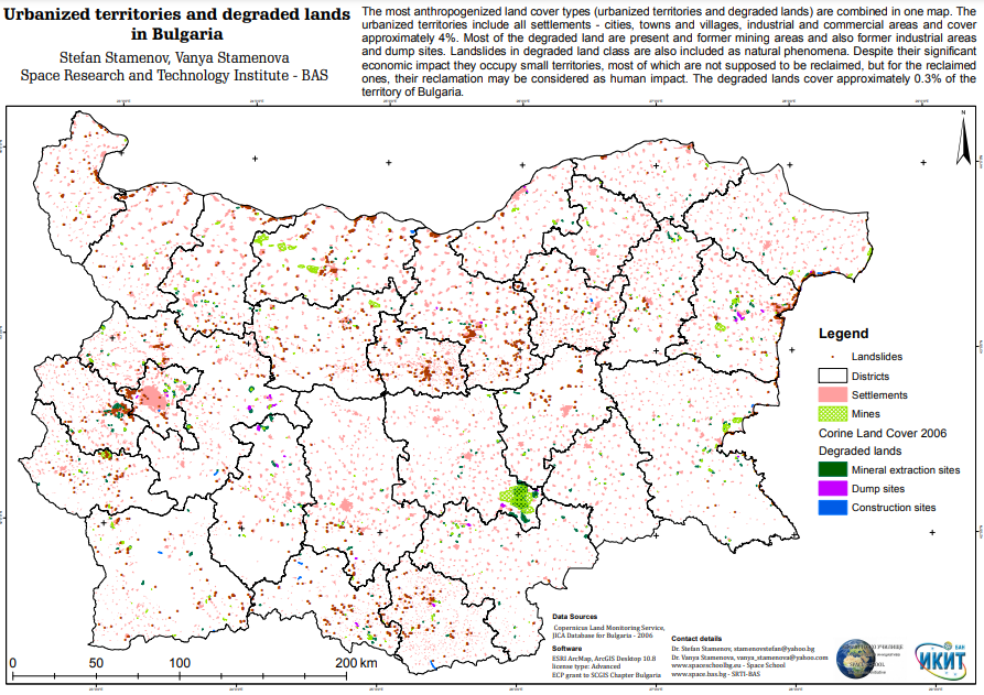
| Urbanized territories and degraded lands in Bulgaria Stefan Stamenov & Vanya Stamenova Space Research and Technology Institute - Bulgarian Academy of Sciences The most anthropogenized land cover types (urbanized territories and degraded lands) are combined in one map. The urbanized territories include all settlements - cities, towns and villages, industrial and commercial areas and cover approximately 4%. Most of the degraded land are present and former mining areas and also former industrial areas and dump sites. Landslides in degraded land class are also included as natural phenomena. Despite their significant economic impact they occupy small territories, most of which are not supposed to be reclaimed, but for the reclaimed ones, their reclamation may be considered as human impact. The degraded lands cover approximately 0.3% of the territory of Bulgaria.
|
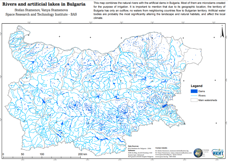
Rivers and artificial lakes in Bulgaria Stefan Stamenov & Vanya Stamenova Space Research and Technology Institute - Bulgarian Academy of Sciences This map combines the natural rivers with the artificial dams in Bulgaria. Most of them are microdams created for the purpose of irrigation. It is important to mention that due to its geographic location, the territory of Bulgaria has only an outflow, no waters from neighboring countries flow to Bulgarian territory. Artificial water bodies are probably the most significantly altering the landscape and natural habitats, and affect the local climate.
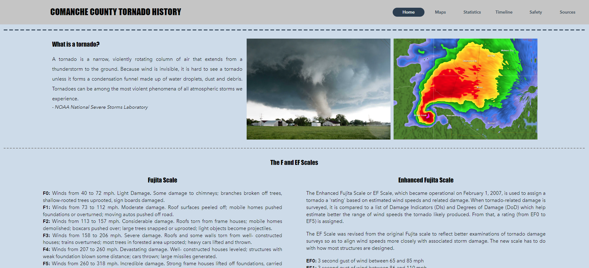
| Comanche County Tornado History: 1950 to 2020 Angela Suffia City of Lawton GIS Division Comanche County is home to Fort Sill, a military base known as the center for US Army Field Artillery. Many soldiers and families come to Fort Sill to train or serve at the base. Moving to Tornado Alley can seem daunting to those from other regions of the country. The goal of this project was to educate Lawton newcomers on the history of tornadoes in the county. While dangerous, the number of tornadoes is relatively average when compared to surrounding counties in Oklahoma.
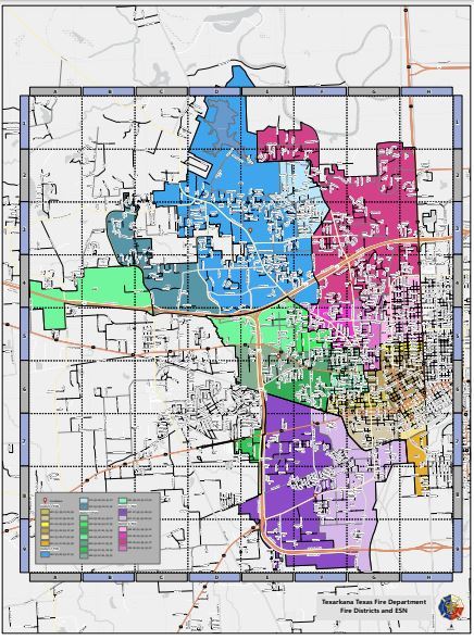
| Texarkana TX Fire Department Districts and ESN's Terri Rogers Texarkana Water Utilities A display showing the Texarkana Texas Fire Departments with Districts and ESN's. It is also has a street index so firefighters can find the street they are looking for fast in case of emergency.
|

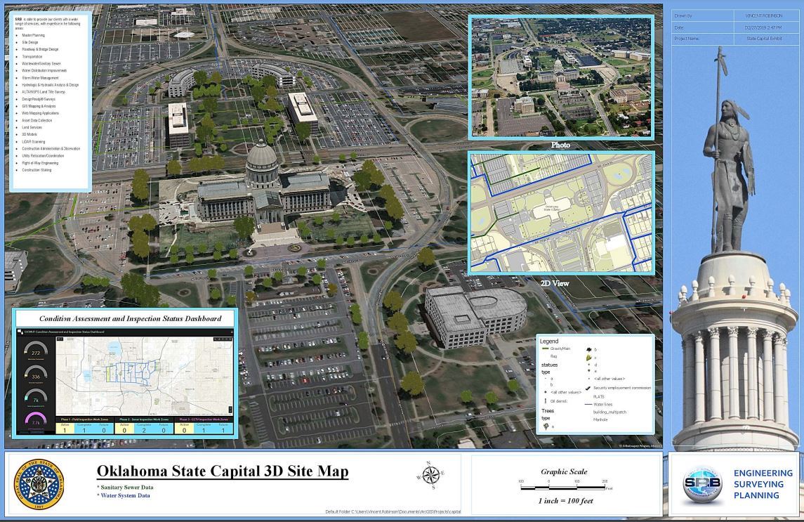
State Capital Vincent Robinson Smith Roberts Baldischwiler
|

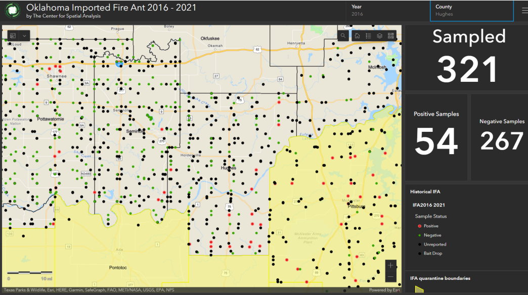
Northeast Oklahoma COVID-19 Resource Janelle Ivey GGEDA This dashboard was created as a resource to help the public of Northeast Oklahoma 7 county region with info about the current COVID-19 pandemic. And site to help find emergency operations options in their area. 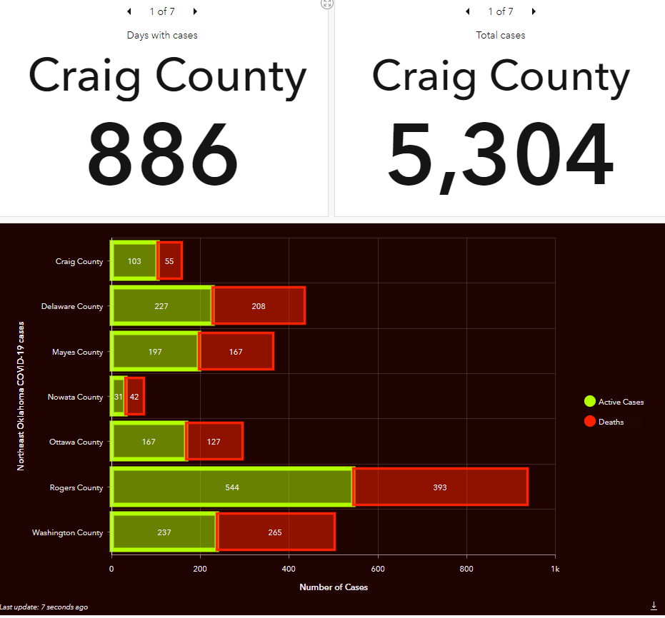 | Oklahoma Historic Imported Fire Ant Map Candace Johnston and Daniela Spade University of Oklahoma Center for Spatial Analysis The red imported fire ant (IFA), Solenopsis invicta Buren entered the United States from South America at a port in Mobile, Alabama in the early 1900’s. The red imported fire ant is damaging to crops, agriculture equipment, and wildlife. The USDA has enforced a federal quarantine in 14 states including Oklahoma to prevent the spread of IFA. The USDA works with these states in an effort to manage IFA and regulate treatments. This dashboard has been created for the Oklahoma Department of Agriculture, Food, and Forestry by the Center for Spatial Analysis as a means to view the progression of the red imported fire ant across the state of Oklahoma dating back to 2016 when sample collection included spatial information.
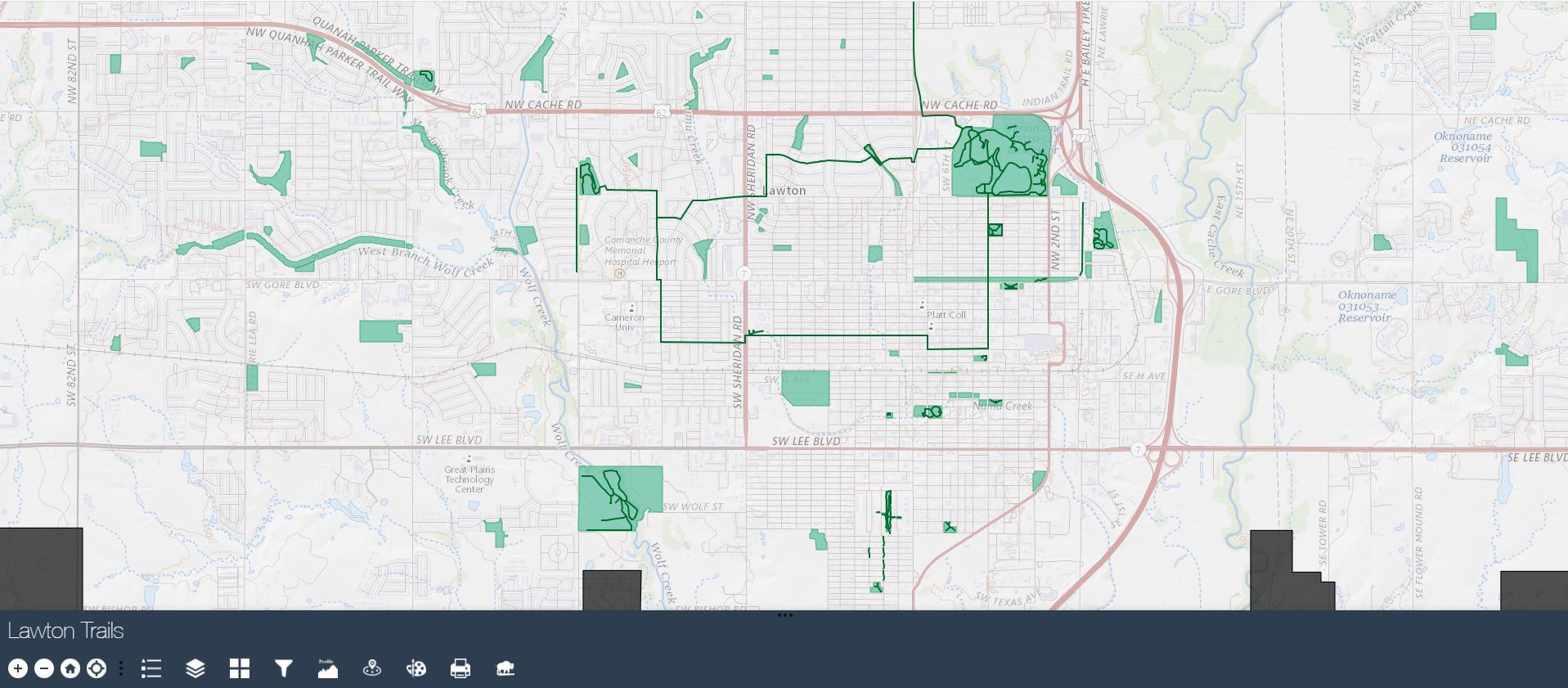
| Lawton Trails Kristi Shannon City of Lawton The intent of this application is to provide Lawtonians and visitors a useful interactive map of trails in the area, including Medicine Park and Wichita Mountains Wildlife Refuge. This will be a great way to promote healthy habits and environmentally friendly transportation. City of Lawton parks and trails web map application was built using Web App Builder Developer's Addition.
|
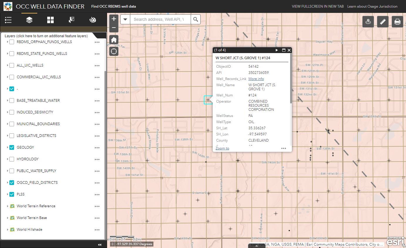
OCC Well Data Finder Colin Brooks Oklahoma Corporation Commission Layer-rich mapping application displaying oil and gas well data curated by the Oklahoma Corporation Commission. Multiple outside data sources are included for geologic and hydrogeologic reference (sources cited in item descriptions). Cultural data and political districts also included for convenience.
| OU's 2022 Incoming Football Players Rose Nordhues, Candace Johnston Center for Spatial Analysis
|


Comanche County Tornado History
Angela Suffia City of Lawton GIS Division Comanche County is home to Fort Sill, a military base known as the center for US Army Field Artillery. Many soldiers and families come to Fort Sill to train or serve at the base. Moving to Tornado Alley can seem daunting to those from other regions of the country. The goal of this project was to educate Lawton newcomers on the history of tornadoes in the county.
| Arts in the Park Vincent Robinson Smith Roberts Baldischwiler Arts in the part tour guide.
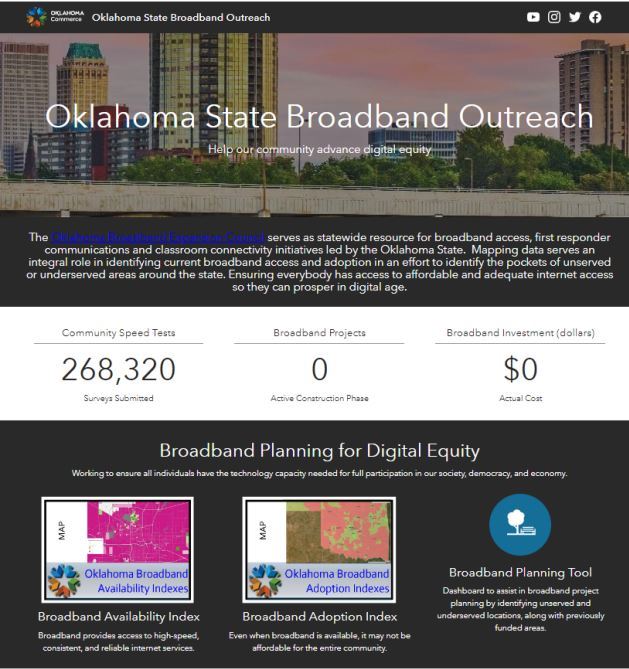
| Oklahoma State Broadband Outreach Mike Sexton & Dat Nguyen ODOC - GIS The Oklahoma Broadband Expansion Council serves as statewide resource for broadband access, first responder communications and classroom connectivity initiatives led by the Oklahoma State. Mapping data serves an integral role in identifying current broadband access and adoption in an effort to identify the pockets of unserved or underserved areas around the state. Ensuring everybody has access to affordable and adequate internet access so they can prosper in digital age.
|

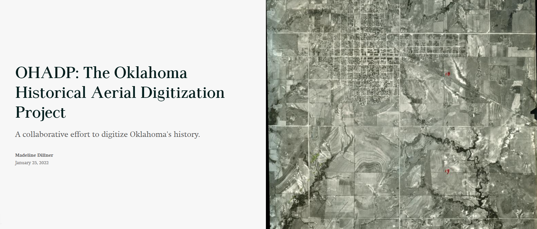
| The Oklahoma Historical Aerial Digitization Project Madeline Dillner Oklahoma Corporation Commission Learn more about this collaborative effort to digitize Oklahoma's history.
*This entry is by an OKSCAUG Steering Committee Member and is therefore ineligible for voting.
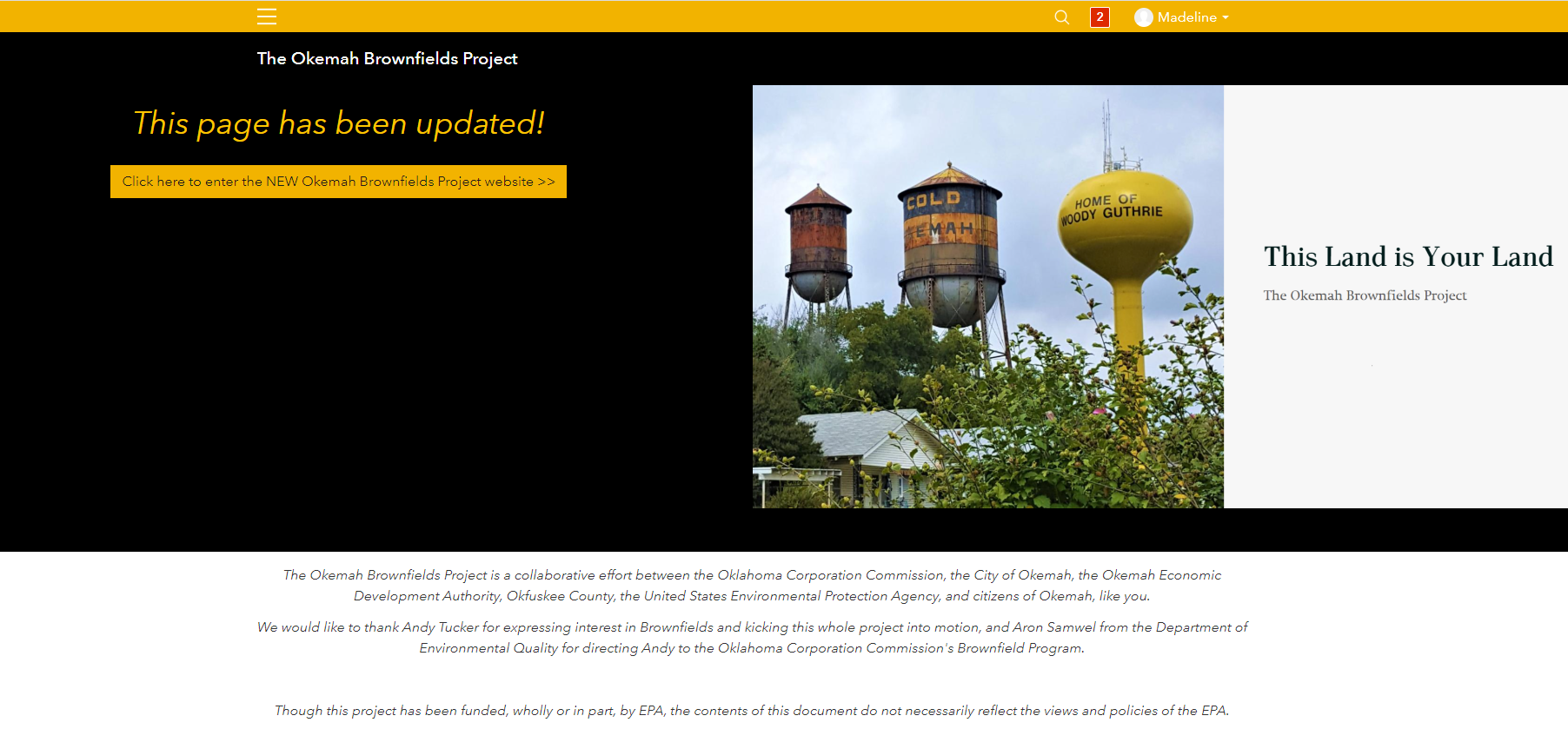
| The Okemah Brownfields Project Madeline Dillner Oklahoma Corporation Commission This ArcGIS Hub site provides a one-stop-shop for information on the Okemah Brownfields Project, a $300,000-grant project addressing historic gas stations in the hometown of Woody Guthrie--Okemah, Oklahoma. Hub was used because of the ability to customize a URL: https://the-okemah-brownfields-project-occokc.hub.arcgis.com/ but now it serves as a jumping-off point to the Okemah Brownfields Project StoryMap. *This entry is by an OKSCAUG Steering Committee Member and is therefore ineligible for voting.
|

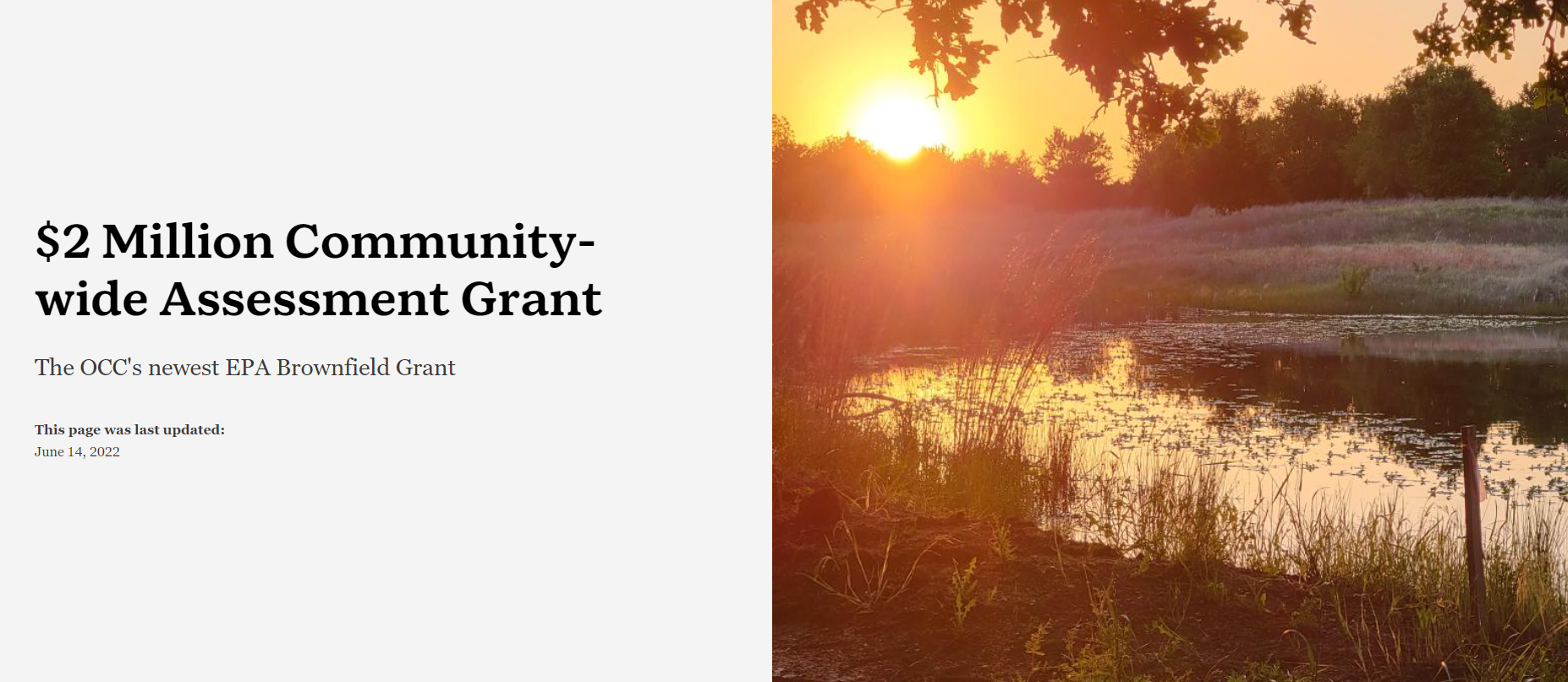
The OCC's $2 Million Community-Wide Assessment Grant for States and Tribes Madeline Dillner Oklahoma Corporation Commission In May of 2022, The EPA announced that the Oklahoma Corporation Commission would be one of the first agencies ever to receive the EPA's newest Brownfield Grant: A $2M Supersize Community-Wide Assessment Grant for States and Tribes. The OCC will use 100% of the grant on contracting activities. That is, the $2M will be used to pay Environmental Consultants to perform Environmental Site Assessments on properties that have fallen into disrepair due to their historic association with industries under OCC's jurisdiction but are now ready for redevelopment. This StoryMap is the one-stop-shop for information about this grant, which needs to be spent by September 20, 2027. *This entry is by an OKSCAUG Steering Committee Member and is therefore ineligible for voting.
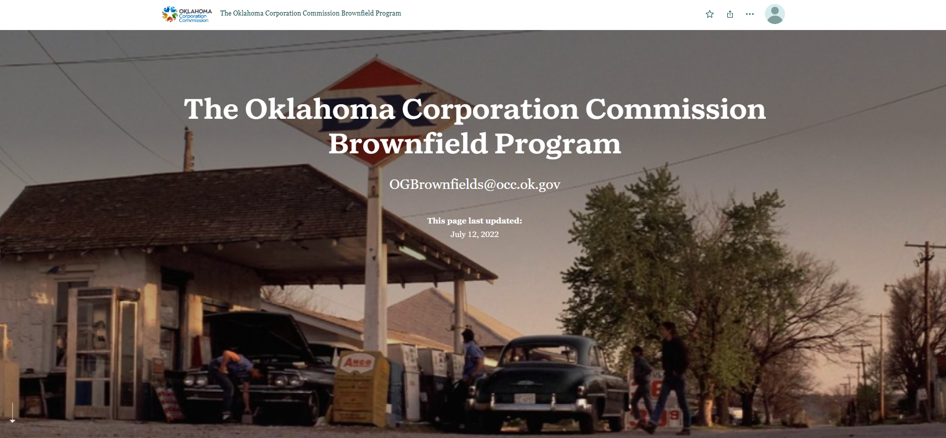
| The Oklahoma Corporation Commission's Brownfield Program Madeline Dillner Oklahoma Corporation Commission Learn more about this economic-meets-environmental grant program at the Oklahoma Corporation Commission--the state agency that regulates the oil and gas industry. If you or anyone you know is buying an oilfield property or a gas station--call us first! We might just have a grant for that. *This entry is by an OKSCAUG Steering Committee Member and is therefore ineligible for voting.
|
Contact SCAUG at : Webmaster@scaug.org | South Central Arc Users Group P.O. Box 96 Ardmore, OK 73402 |
